Free Courses Sale ends Soon, Get It Now


Free Courses Sale ends Soon, Get It Now


Copyright infringement not intended
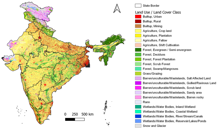
Picture Courtesy: https://www.researchgate.net/figure/Land-use-land-cover-map-for-India_fig4_350283339
Context: A recent study by the National Remote Sensing Centre (NRSC) reveals a substantial increase in built-up areas, signifying a rapid urbanisation and infrastructure boom over the past 17 years (2005-2023).
Key Highlights of the Study
|
Remote sensing technology, as employed by the NRSC, plays a crucial role in monitoring land use changes over time, providing essential data for evidence-based policy formulation and environmental management. |
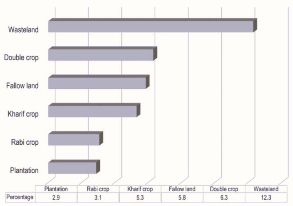
Contribution of different land covers to built-up extents

Challenges Associated with Expansion

Steps to Address Challenges
Conclusion
Source:
|
PRACTICE QUESTION Q. India's agricultural land is being converted to built-up areas at a significant rate. How can India ensure long-term food security considering this changing land-use pattern and a growing population? Can technology like vertical farming or improved agricultural practices bridge the potential gap in food production? |
© 2024 iasgyan. All right reserved