Free Courses Sale ends Soon, Get It Now


SVAMITVA SCHEME

26th April, 2023

Copyright infringement not intended

Context: On April 24, National Panchayati Raj Day, the Prime Minister digitally handed over about 20,98,926 'gharaunis' to Uttar Pradesh beneficiaries under the Pradhan Mantri Svamitva Yojana (which aims to establish clear ownership of property in rural areas).

SVAMITVA scheme

About

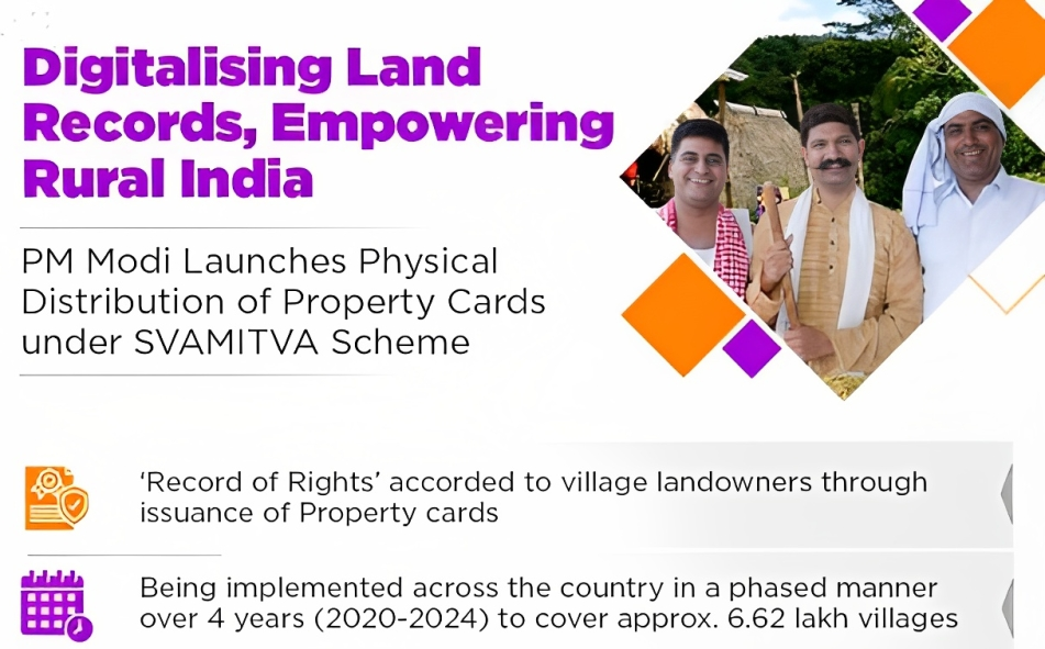
  • The Prime Minister launched the SVAMITVA (Survey of Villages and Mapping with Improvised Technology in Village Areas) scheme on April 24, 2020.
  • The scheme is the result of collaboration between the Ministry of Panchayati Raj, state Panchayati Raj Departments, state Revenue Departments, and the Survey of India.
  • Under the scheme, drone technology is used to map and survey rural land parcels and provide property cards to the owners.
  • It aims to cover about 6.62 lakh villages across the country by 2024.

Objectives

  • Empower the rural population by giving them legal recognition of their land rights and enabling them to access various benefits and services.
  • Promotes social harmony and reduces land disputes by creating a clear and accurate record of land ownership.
  • Enhances the economic opportunities for the rural people by allowing them to use their land as collateral for loans, insurance, and other financial products.
  • Improves the governance and administration of rural areas by facilitating better planning, taxation, and delivery of public services.
  • Strengthens the democratic participation and empowerment of rural citizens by enabling them to vote, contest elections, and access welfare schemes based on their property cards.

Components

  • Drone survey and mapping of rural inhabited lands
  • Updating of land records and property registration
  • Issuance of property cards to the owners
  • Development of spatial planning framework for villages

Challenges

Lack of awareness and participation

  • Many rural people are not aware of the benefits and procedures of the scheme, and may not participate in the verification and validation process of their property rights.
  • This may lead to low coverage and inclusion of eligible beneficiaries.

Technical and operational issues

  • The scheme relies on high-end technology such as drones, CORS, GIS, and cloud computing, which may pose challenges in terms of availability, accessibility, accuracy, and security.
  • The scheme also requires coordination and collaboration among various stakeholders such as central and state governments, survey agencies, panchayats, and citizens, which may involve delays, discrepancies, and disputes.

Legal and institutional barriers

  • The scheme aims to provide legal ownership cards to rural households, but these cards may not be recognized or accepted by all authorities and institutions as valid proof of property rights.
  • The scheme also needs to harmonize with existing laws and regulations related to land tenure, registration, taxation, and inheritance, which may vary across states and regions.

Social and Environmental Concerns

  • The scheme may have unintended social and environmental consequences such as increased land conflicts, displacement, encroachment, fragmentation, degradation, and loss of biodiversity.
  • The scheme also needs to ensure that it does not violate or undermine the customary and collective rights of indigenous and tribal communities over their lands and resources.

Suggestions

  • The Scheme involves multiple stakeholders at different levels. There is a need to strengthen the capacity and coordination of these stakeholders through regular training, awareness campaigns, feedback mechanisms and grievance redressal systems.
  • Improve the quality and accuracy of data by adopting standard operating procedures, quality control measures, data validation methods and periodic audits.
  • Enhance the awareness and participation of beneficiaries by conducting mass media campaigns, community mobilization activities, digital literacy programs and financial inclusion initiatives.
  • Expand the scope and coverage of the scheme by including these types of properties in the survey and mapping process and issuing property cards for them as well.
  • Integrate the scheme with other development programs that can complement and reinforce its impact and benefits for rural households.

Conclusion

  • The SVAMITVA Scheme is a bold and transformative step towards realising the vision of 'Aatmanirbhar Bharat,' or self-sufficiency in India. It will strengthen the confidence and aspirations of millions of rural landowners by providing them with legal identification and dignity.
  • By releasing the potential of rural assets and resources, the initiative will also contribute to the nation's general development and prosperity.

Must Read Articles:

SVAMITVA Scheme: https://www.iasgyan.in/daily-current-affairs/svamitva-scheme-48

PM Awas Yojana: https://www.iasgyan.in/daily-current-affairs/pm-awas-yojana-32

PRACTICE QUESTION

Q. What are the main challenges and limitations of using drones for surveying and mapping rural lands under the SVAMITVA SCHEME? Discuss with reference to the legal, technical, social, and environmental aspects of drone-based mapping.

https://www.hindustantimes.com/cities/lucknow-news/up-distributes-55-lakh-gharaunis-under-pm-svamitva-yojana-cm-yogi-adityanath-thanks-pm-modi-101682356813222.html